
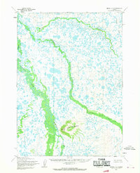
1954 Map of Bethel C-6
USGS Topo · Published 1965About this map
The Kushluk River meanders across this mid-century Alaskan landscape, defining a region characterized by a complex network of thousands of small tundra ponds and interconnected waterways. The most prominent topographical landmark is Three Step Mountain, rising above the low-lying wetlands with its distinct peak named Della. This 1954 survey, edited by the Geological Survey, provides an unvarnished look at the intricate hydrology of the Yukon-Kuskokwim Delta region. The Kwethluk River and Akalikutak River thread through the terrain, illustrating the natural drainage patterns before modern infrastructure. Mapping here relied on 1957 aerial photography and 1954 field annotations, reflecting a period when the Bureau of Land Management was predetermining land lines for unsurveyed territory.
Find a feature on this map
6 named features on this map. Tap any name to fly to it.
Don’t see what you’re looking for? This feature index may not catch every label — zoom into the map to look around manually.
Map Details
Editions of this 1954 Bethel C-6 Map
2 editions found
Other maps of this area

1950 · Bethel
USGS Topo · 1:250,000

1954 · Bethel B-6
USGS Topo · 1:63,360

1954 · Bethel C-5
USGS Topo · 1:63,360

1954 · Bethel D-7
USGS Topo · 1:63,360

1954 · Bethel B-7
USGS Topo · 1:63,360

1954 · Bethel D-6
USGS Topo · 1:63,360
1954 · Bethel C-7
USGS Topo · 1:63,360

1954 · Bethel D-5
USGS Topo · 1:63,360

1954 · Bethel B-5
USGS Topo · 1:63,360

1980 · Bethel
USGS Topo · 1:250,000