
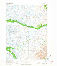
1954 Map of Goodnews D-6
USGS Topo · Published 1968About this map
The Kanektok River dominates the southwestern quadrant of this Alaskan landscape, part of a complex watershed mapped in the mid-1950s. The drainage system is further defined by the Middle Fork and the Ugalik River, which wind through the terrain as primary watercourses. This survey by the Army Map Service and the Geological Survey captures the region's topography before significant modern shifts, emphasizing the natural corridors created by these rivers. To the northeast, the Great Ridge provides a prominent elevation landmark, while the small label for Eck marks a specific point of interest along the drainage of the Middle Fork. The map illustrates a remote wilderness defined by its hydraulic patterns and high-relief ridges, offering an exact record of the land as it was documented through 1957 aerial photography and 1954 field work.
Find a feature on this map
5 named features on this map. Tap any name to fly to it.
Don’t see what you’re looking for? This feature index may not catch every label — zoom into the map to look around manually.
Map Details
Editions of this 1954 Goodnews D-6 Map
This is the sole edition of this map. No revisions or reprints were ever made.
Other maps of this area

1950 · Bethel
USGS Topo · 1:250,000

1951 · Goodnews
USGS Topo · 1:250,000

1954 · Bethel A-5
USGS Topo · 1:63,360

1954 · Bethel A-7
USGS Topo · 1:63,360

1954 · Goodnews C-7
USGS Topo · 1:63,360

1954 · Goodnews D-7
USGS Topo · 1:63,360

1954 · Goodnews D-5
USGS Topo · 1:63,360

1954 · Goodnews C-6
USGS Topo · 1:63,360

1954 · Bethel A-6
USGS Topo · 1:63,360
1964 · Bethel A-6
USGS Topo · 1:63,360