
1954 Map of Goodnews C-6
USGS Topo · Published 1969About this map
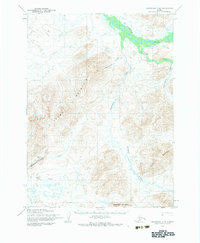
The Kanektok River dominates the northern reaches of this Bethel region landscape, winding through a complex network of wetlands and tributaries. The terrain is defined by prominent peaks including Thumb Mountain and Ingluingok Mountain, which rise above a series of drainage systems. These waterways, such as Nukluk Creek and Takshilik Creek, illustrate a watershed undisturbed by modern development during the mid-century. Mapping efforts by the Army Map Service in the 1950s utilized photogrammetric methods to document this area, capturing the natural hydrology of Nimgun Creek and the southern slopes of Chingekigtlik Mountain. The absence of man-made structures or roads emphasizes the primary importance of the river systems and topographic landmarks for navigation in this part of Alaska.
Find a feature on this map
12 named features on this map. Tap any name to fly to it.
Don’t see what you’re looking for? This feature index may not catch every label — zoom into the map to look around manually.
Map Details
Editions of this 1954 Goodnews C-6 Map
2 editions found
Other maps of this area

1951 · Goodnews
USGS Topo · 1:250,000

1954 · Goodnews B-7
USGS Topo · 1:63,360

1954 · Goodnews C-7
USGS Topo · 1:63,360

1954 · Goodnews D-6
USGS Topo · 1:63,360

1954 · Goodnews D-7
USGS Topo · 1:63,360

1954 · Goodnews D-5
USGS Topo · 1:63,360

1954 · Goodnews B-6
USGS Topo · 1:63,360

1979 · Goodnews Bay C-5
USGS Topo · 1:63,360

1979 · Goodnews Bay B-5
USGS Topo · 1:63,360

1979 · Goodnews Bay
USGS Topo · 1:250,000