
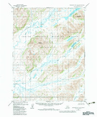
1979 Map of Goodnews Bay B-5
USGS Topo · Published 1979About this map
The Goodnews River drainage system dominates this Alaskan landscape, captured during a 1970s photogrammetric survey. This remote interior region is defined by the convergence of the Middle Fork Goodnews River and the Kukaktlik River, illustrating a complex network of glacial meltwater and tundra streams. In the northeast, Goodnews Lake sits at the base of Ungluayagat Mountain, while Nagyagat Mountain rises in the central portion of the quadrangle. The lack of roads or established settlements on the map underscores the area's wilderness state during the late twentieth century, with the Quigmy River and Awayak Creek providing the primary geographical landmarks across the sprawling marsh and upland terrain.
Find a feature on this map
10 named features on this map. Tap any name to fly to it.
Don’t see what you’re looking for? This feature index may not catch every label — zoom into the map to look around manually.
Map Details
Editions of this 1979 Goodnews Bay B-5 Map
2 editions found
Other maps of this area

1951 · Goodnews
USGS Topo · 1:250,000

1954 · Goodnews C-4
USGS Topo · 1:63,360

1954 · Goodnews A-4
USGS Topo · 1:63,360

1954 · Goodnews A-6
USGS Topo · 1:63,360

1954 · Goodnews B-6
USGS Topo · 1:63,360

1954 · Goodnews C-6
USGS Topo · 1:63,360

1979 · Goodnews Bay C-5
USGS Topo · 1:63,360

1979 · Goodnews Bay A-5
USGS Topo · 1:63,360

1979 · Goodnews Bay
USGS Topo · 1:250,000
1979 · Goodnews Bay B-4
USGS Topo · 1:63,360