
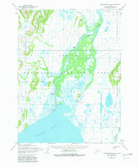
1954 Map of Goodnews A-4
USGS Topo · Published 1968About this map
Togiak stands at the northern edge of Togiak Bay, serving as a focal point for this coastal Alaskan landscape mapped in the early 1950s. The settlement is supported by a Landing Field situated along the shoreline, marking its role as a remote transportation hub. The massive braided channel of the Togiak River dominates the central terrain, weaving through an expansive wetland complex before emptying into the bay.
Find a feature on this map
13 named features on this map. Tap any name to fly to it.
Don’t see what you’re looking for? This feature index may not catch every label — zoom into the map to look around manually.
Map Details
Editions of this 1954 Goodnews A-4 Map
2 editions found
Other maps of this area

1947 · Hagemeister Island D-2
USGS Topo · 1:63,360

1950 · Hagemeister Island D-1
USGS Topo · 1:63,360

1951 · Goodnews
USGS Topo · 1:250,000

1951 · Hagemeister Island
USGS Topo · 1:250,000

1952 · Hagemeister Island D-1
USGS Topo · 1:63,360

1953 · Hagemeister Island D-2
USGS Topo · 1:63,360

1954 · Goodnews B-3
USGS Topo · 1:63,360

1954 · Goodnews A-3
USGS Topo · 1:63,360

1957 · Hagemeister Island
USGS Topo · 1:250,000

1979 · Goodnews Bay A-5
USGS Topo · 1:63,360