
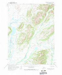
1954 Map of Goodnews A-3
USGS Topo · Published 1969About this map
The braided channels of the Negukthlik River and the meandering path of the Ungalikthluk River define this stretch of the Alaskan wilderness as it was documented in the early 1950s. Located within the Seward Meridian, the landscape is a complex network of glacial meltwater and tundra wetlands. Topographic peaks such as Sharp, Center, and Eddy rise above the river valleys, providing distinct landmarks in a region largely devoid of permanent settlements or infrastructure. The Kulukak River flows through the eastern portion of the quadrangle, illustrating the drainage patterns that characterize this coastal hinterland. This survey reflects the detailed photogrammetric work of the Army Map Service, capturing a moment when the land remained primarily unsurveyed and unmarked, with townships predetermined by the Bureau of Land Management but not yet physically established on the ground.
Find a feature on this map
7 named features on this map. Tap any name to fly to it.
Don’t see what you’re looking for? This feature index may not catch every label — zoom into the map to look around manually.
Map Details
Editions of this 1954 Goodnews A-3 Map
2 editions found
Other maps of this area

1945 · Nushagak Bay
USGS Topo · 1:250,000

1949 · Nushagak Bay
USGS Topo · 1:250,000

1950 · Nushagak Bay D-6
USGS Topo · 1:63,360

1950 · Hagemeister Island D-1
USGS Topo · 1:63,360

1951 · Goodnews
USGS Topo · 1:250,000

1951 · Hagemeister Island
USGS Topo · 1:250,000

1951 · Nushagak Bay
USGS Topo · 1:250,000

1952 · Hagemeister Island D-1
USGS Topo · 1:63,360

1954 · Goodnews B-3
USGS Topo · 1:63,360

1954 · Goodnews A-4
USGS Topo · 1:63,360