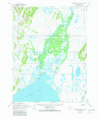
1954 Map of Goodnews Bay A-4
USGS Topo · Published 1982About this map
Togiak Bay and the surrounding marshlands of southwestern Alaska are documented here during a mid-century period of transition. The landscape is defined by the massive drainage of the Togiak River, which winds through the Togiak National Wildlife Refuge toward the coast. The settlement of Togiak stands as the primary hub, situated near a Landing Strip that provided essential access to this coastal region.
Find a feature on this map
15 named features on this map. Tap any name to fly to it.
Don’t see what you’re looking for? This feature index may not catch every label — zoom into the map to look around manually.
Map Details
Editions of this 1954 Goodnews Bay A-4 Map
2 editions found
Other maps of this area

1947 · Hagemeister Island D-2
USGS Topo · 1:63,360

1950 · Hagemeister Island D-1
USGS Topo · 1:63,360

1951 · Goodnews
USGS Topo · 1:250,000

1951 · Hagemeister Island
USGS Topo · 1:250,000

1952 · Hagemeister Island D-1
USGS Topo · 1:63,360

1953 · Hagemeister Island D-2
USGS Topo · 1:63,360

1954 · Goodnews B-3
USGS Topo · 1:63,360

1954 · Goodnews A-4
USGS Topo · 1:63,360

1954 · Goodnews A-3
USGS Topo · 1:63,360

1957 · Hagemeister Island
USGS Topo · 1:250,000