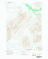
1954 Map of Goodnews C-6
USGS Topo · Published 1984About this map
The Kanektok River dominates the northeastern corner of this Alaskan interior landscape, carving a wide valley floor through an otherwise high-relief region. The terrain is characterized by a series of prominent peaks and drainage systems, including Thumb Mountain and Chingekigtlik Mountain. The drainage network is complex, with Nukluk Creek and Kilokuyak Creek feeding into the main river system while southern waters flow through Nimgun Creek and Flat Creek.
Find a feature on this map
12 named features on this map. Tap any name to fly to it.
Don’t see what you’re looking for? This feature index may not catch every label — zoom into the map to look around manually.
Map Details
Editions of this 1954 Goodnews C-6 Map
2 editions found
Other maps of this area

1951 · Goodnews
USGS Topo · 1:250,000

1954 · Goodnews B-7
USGS Topo · 1:63,360

1954 · Goodnews C-7
USGS Topo · 1:63,360

1954 · Goodnews D-6
USGS Topo · 1:63,360

1954 · Goodnews D-7
USGS Topo · 1:63,360

1954 · Goodnews D-5
USGS Topo · 1:63,360

1954 · Goodnews B-6
USGS Topo · 1:63,360

1954 · Goodnews C-6
USGS Topo · 1:63,360

1979 · Goodnews Bay C-5
USGS Topo · 1:63,360

1979 · Goodnews Bay B-5
USGS Topo · 1:63,360