
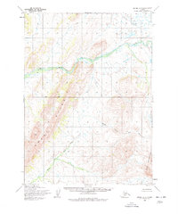
1954 Map of Bethel A-5
USGS Topo · Published 1965About this map
Eek River dominates this mid-century survey of the Alaskan interior, showing the winding waterway as it moves through a landscape of significant relief. Based on aerial photography from 1957 and field annotated in 1954, the map documents the complex drainage of the Middle Fork Eek River as it descends from the high elevations of the Eek Mountains. The survey provides an early look at this region before significant modern alteration, capturing a wilderness defined by the prominent Great Ridge and the surveyor's Base Line. This specific sheet was mapped by the Army Map Service and published by the Geological Survey, illustrating the transition from military to civilian cartographic priorities in the territory during the post-war era.
Find a feature on this map
5 named features on this map. Tap any name to fly to it.
Don’t see what you’re looking for? This feature index may not catch every label — zoom into the map to look around manually.
Map Details
Editions of this 1954 Bethel A-5 Map
2 editions found
Other maps of this area

1950 · Bethel
USGS Topo · 1:250,000

1951 · Goodnews
USGS Topo · 1:250,000

1954 · Bethel B-6
USGS Topo · 1:63,360

1954 · Bethel A-4
USGS Topo · 1:63,360

1954 · Bethel B-4
USGS Topo · 1:63,360

1954 · Goodnews D-4
USGS Topo · 1:63,360

1954 · Bethel B-5
USGS Topo · 1:63,360

1954 · Goodnews D-6
USGS Topo · 1:63,360

1954 · Goodnews D-5
USGS Topo · 1:63,360

1954 · Bethel A-6
USGS Topo · 1:63,360