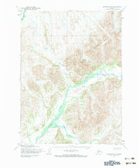
1954 Map of Goodnews D-5
USGS Topo · Published 1983About this map
The Eek Mountains dominate the eastern landscape of this mid-century Alaskan survey, where high ridges rise sharply above the river valleys. The northern portion of the map is defined by the Eek River, which winds through the mountain base, while the southern reaches are shaped by the broad path of the Kanektok River. This watershed is fed by several primary tributaries, including Nakailingak Creek, which flows into the northern river system, and Klak Creek and Sam Creek to the south. Mapped by the Army Map Service using aerial photography, the sheet records a wilderness devoid of roads or trails, showing the natural state of the terrain as it existed during the 1950s. The dense contour lines illustrate the steep drainage patterns typical of this part of the Bethel region, where the rivers serve as the primary geographical markers in an otherwise uninhabited stretch of mountain and tundra.
Find a feature on this map
6 named features on this map. Tap any name to fly to it.
Don’t see what you’re looking for? This feature index may not catch every label — zoom into the map to look around manually.
Map Details
Editions of this 1954 Goodnews D-5 Map
2 editions found
Other maps of this area

1950 · Bethel
USGS Topo · 1:250,000

1951 · Goodnews
USGS Topo · 1:250,000

1954 · Bethel A-5
USGS Topo · 1:63,360

1954 · Bethel A-4
USGS Topo · 1:63,360

1954 · Goodnews C-4
USGS Topo · 1:63,360

1954 · Goodnews D-4
USGS Topo · 1:63,360

1954 · Goodnews D-6
USGS Topo · 1:63,360

1954 · Goodnews D-5
USGS Topo · 1:63,360

1954 · Goodnews C-6
USGS Topo · 1:63,360

1954 · Bethel A-6
USGS Topo · 1:63,360