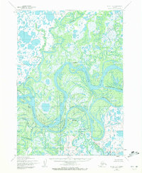
1954 Map of Bethel D-7
USGS Topo · Published 1972About this map
Kuskokwim River dominates this landscape of the Yukon-Kuskokwim Delta, where a labyrinthine network of sloughs and tributary rivers defines the pattern of movement and settlement. Established communities like Akiachak and Kwethluk are situated along these vital waterways, serving as hubs in a region where transport relies heavily on the river systems. The map shows the intricate drainage of the Kwethluk River and Tupuknuk River, alongside notable smaller settlements such as Nunapitchuk. A lone Landing Strip at Akiachak highlights the emerging role of aviation in connecting these remote points during the mid-20th century. The presence of Church Slough and Kuskokuak Slough illustrates the complex, shifting nature of the delta's hydrology, with numerous tidal flats and islands like Kiktak Is marking the seasonal ebb and flow of the glacial waters.
Find a feature on this map
16 named features on this map. Tap any name to fly to it.
Don’t see what you’re looking for? This feature index may not catch every label — zoom into the map to look around manually.
Map Details
Editions of this 1954 Bethel D-7 Map
3 editions found
Other maps of this area

1947 · Russian Mission
USGS Topo · 1:250,000

1950 · Russian Mission
USGS Topo · 1:250,000

1950 · Bethel
USGS Topo · 1:250,000

1954 · Russian Mission A-6
USGS Topo · 1:63,360

1954 · Russian Mission A-8
USGS Topo · 1:63,360
1954 · Russian Mission A-7
USGS Topo · 1:63,360

1954 · Bethel D-8
USGS Topo · 1:63,360

1954 · Bethel C-6
USGS Topo · 1:63,360

1954 · Bethel D-7
USGS Topo · 1:63,360

1954 · Bethel D-6
USGS Topo · 1:63,360