
1954 Map of Bethel D-8
USGS Topo · Published 1965About this map
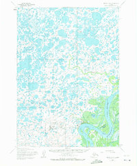
Bethel serves as the focal point of this mid-century survey, situated along the complex hydrology of the Kuskokwim River. The landscape is dominated by a dense network of water features, including Steamboat Slough, Church Slough, and the large Tidal Flat areas that define the river's path. This period represents a significant era of infrastructure development for the region, evidenced by the proximity of the Bethel Airforce Station, the Bethel Municipal Airport, and a Heliport. Small local landmarks such as Nighead and Hangar Lake provide specific geographic markers within the tundra. The mapping detail shows the intricate relationship between the settlement and its waterways, where labels like Tubungaluk Creek and Tupuknuk illustrate the indigenous and maritime character of this Southwestern Alaska hub.
Find a feature on this map
14 named features on this map. Tap any name to fly to it.
Don’t see what you’re looking for? This feature index may not catch every label — zoom into the map to look around manually.
Map Details
Editions of this 1954 Bethel D-8 Map
4 editions found
Other maps of this area

1947 · Russian Mission
USGS Topo · 1:250,000

1950 · Russian Mission
USGS Topo · 1:250,000

1950 · Bethel
USGS Topo · 1:250,000

1951 · Marshall
USGS Topo · 1:250,000

1951 · Baird Inlet
USGS Topo · 1:250,000

1954 · Russian Mission A-8
USGS Topo · 1:63,360
1954 · Russian Mission A-7
USGS Topo · 1:63,360

1954 · Marshall A-1
USGS Topo · 1:63,360

1954 · Bethel D-7
USGS Topo · 1:63,360

1954 · Bethel C-8
USGS Topo · 1:63,360