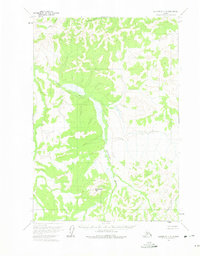
1954 Map of Sleetmute C-5
USGS Topo · Published 1975About this map
The Oskawalik River dominates this interior Alaskan landscape, winding through a wide valley of wetlands and complex drainage systems. Recorded during a mid-century aerial survey, the map shows the river flowing past Henderson Mtn, a prominent peak that serves as the area's primary topographical anchor. The lack of roads or established trails highlights the wilderness character of the region during this era. Tributaries like Eightmile Creek, Downey Creek, and Vreeland Creek feed into the Oskawalik, illustrating a terrain defined by its natural watercourses. The Survey noted that land lines were predetermined by the Bureau of Land Management but remained unsurveyed and unmarked on the ground at the time of publication.
Find a feature on this map
5 named features on this map. Tap any name to fly to it.
Don’t see what you’re looking for? This feature index may not catch every label — zoom into the map to look around manually.
Map Details
Editions of this 1954 Sleetmute C-5 Map
2 editions found
Other maps of this area

1950 · Sleetmute
USGS Topo · 1:250,000

1954 · Sleetmute C-4
USGS Topo · 1:63,360

1954 · Sleetmute D-5
USGS Topo · 1:63,360

1954 · Sleetmute D-4
USGS Topo · 1:63,360

1954 · Sleetmute D-6
USGS Topo · 1:63,360

1954 · Sleetmute C-6
USGS Topo · 1:63,360

1954 · Sleetmute C-5
USGS Topo · 1:63,360

1954 · Sleetmute
USGS Topo · 1:250,000

1954 · Sleetmute B-5
USGS Topo · 1:63,360

1954 · Sleetmute B-4
USGS Topo · 1:63,360