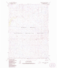
1954 Map of Marshall B-3
USGS Topo · Published 1981About this map
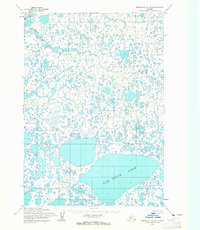
Izaviknek River meanders across this mid-century Alaskan landscape, defining the hydrological character of the vast Yukon Delta National Wildlife Refuge. The terrain is characterized by a dense network of marshes and unnamed ponds, typical of the delta's low-lying alluvial plains where water and land are in constant flux. To the south, Kuka Creek cuts through the wetlands, providing further drainage for this complex ecosystem. Mapped primarily through photogrammetric methods from aerial photographs taken in the early 1950s, the survey documents a wilderness area largely devoid of permanent human structures or infrastructure. This absence of roads or settlements emphasizes the protected and primitive nature of the refuge during this era, serving as a baseline for environmental historians and researchers studying the shifting watercourses and wilderness boundaries of the Bethel region.
Find a feature on this map
3 named features on this map. Tap any name to fly to it.
Don’t see what you’re looking for? This feature index may not catch every label — zoom into the map to look around manually.
Map Details
Editions of this 1954 Marshall B-3 Map
3 editions found
Other maps of this area

1951 · Marshall
USGS Topo · 1:250,000

1954 · Marshall B-4
USGS Topo · 1:63,360

1954 · Marshall C-3
USGS Topo · 1:63,360
1954 · Marshall C-2
USGS Topo · 1:63,360

1954 · Marshall B-3
USGS Topo · 1:63,360

1954 · Marshall A-2
USGS Topo · 1:63,360

1954 · Marshall A-3
USGS Topo · 1:63,360

1954 · Marshall C-4
USGS Topo · 1:63,360
1954 · Marshall B-2
USGS Topo · 1:63,360
1954 · Marshall A-4
USGS Topo · 1:63,360