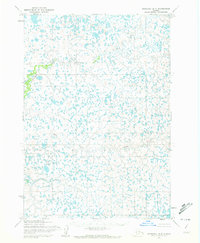
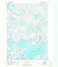
1954 Map of Marshall B-3
USGS Topo · Published 1972About this map
Izaviknek River winds through the northern reaches of this tundra landscape, while the serpentine course of Kuka Creek dominates the central and southern sections. This 1950s survey, published in 1972, reveals a complex network of thousands of unnamed thaw lakes and wetlands characteristic of the Yukon-Kuskokwim Delta region. The lack of roads, trails, or permanent settlements emphasizes the seasonal and water-dependent nature of travel and subsistence in this part of Alaska during the mid-20th century. Mapped using photogrammetric methods from aerial photographs taken in 1951 and 1952, the topography is marked by subtle elevation changes and intricate drainage patterns that defined the environment before more modern developments reached the interior.
Find a feature on this map
2 named features on this map. Tap any name to fly to it.
Don’t see what you’re looking for? This feature index may not catch every label — zoom into the map to look around manually.
Map Details
Editions of this 1954 Marshall B-3 Map
3 editions found
Other maps of this area

1951 · Marshall
USGS Topo · 1:250,000

1954 · Marshall B-4
USGS Topo · 1:63,360

1954 · Marshall C-3
USGS Topo · 1:63,360
1954 · Marshall C-2
USGS Topo · 1:63,360

1954 · Marshall B-3
USGS Topo · 1:63,360

1954 · Marshall A-2
USGS Topo · 1:63,360

1954 · Marshall A-3
USGS Topo · 1:63,360

1954 · Marshall C-4
USGS Topo · 1:63,360
1954 · Marshall B-2
USGS Topo · 1:63,360
1954 · Marshall A-4
USGS Topo · 1:63,360