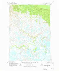
1954 Map of Marshall B-1
USGS Topo · Published 1976About this map
Johnson River meanders through the eastern portion of this subarctic landscape, where the Army Map Service captured a complex drainage system via aerial photography in the early 1950s. The terrain is defined by a dense network of seasonal wetlands and small lakes that Feed into Putu Creek and Mogak Creek. These waterways form the primary geographic features of this unpopulated region in the Seward Meridian area, which remained largely unsurveyed for land ownership at the time of publication. The intricate hydrology shown here, with countless unnamed ponds and oxbows, illustrates the raw nature of the Alaskan interior before modern development or formal road infrastructure reached these reaches of the Bethel region.
Find a feature on this map
4 named features on this map. Tap any name to fly to it.
Don’t see what you’re looking for? This feature index may not catch every label — zoom into the map to look around manually.
Map Details
Editions of this 1954 Marshall B-1 Map
2 editions found
Other maps of this area

1947 · Russian Mission
USGS Topo · 1:250,000

1950 · Russian Mission
USGS Topo · 1:250,000

1951 · Marshall
USGS Topo · 1:250,000

1952 · Russian Mission C-8
USGS Topo · 1:63,360

1952 · Russian Mission B-8
USGS Topo · 1:63,360

1952 · Marshall C-1
USGS Topo · 1:63,360

1954 · Russian Mission A-8
USGS Topo · 1:63,360
1954 · Marshall C-2
USGS Topo · 1:63,360

1954 · Marshall A-2
USGS Topo · 1:63,360

1954 · Marshall A-1
USGS Topo · 1:63,360