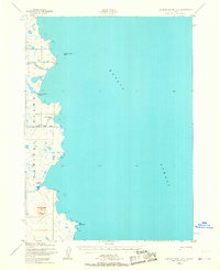
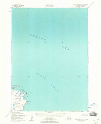
1952 Map of Nunivak Island A-2
USGS Topo · Published 1967About this map
Nunivak Island meets the cold waters of Etolin Strait in this early 1950s survey, documenting a coastline defined by seasonal settlements and complex maritime geography. The map identifies several historical village sites, including Kanikyakstalikmiut, Ahnikdoligamiut, and Ingrimiut, which provide essential grounding for those researching the indigenous habitation of the Bering Sea region. The interior is sparsely detailed, save for prominent landforms like Twin Mountain and the winding course of the Kaliksneethnoak.
Find a feature on this map
13 named features on this map. Tap any name to fly to it.
Don’t see what you’re looking for? This feature index may not catch every label — zoom into the map to look around manually.
Map Details
Editions of this 1952 Nunivak Island A-2 Map
2 editions found
Other maps of this area

1951 · Cape Mendenhall
USGS Topo · 1:250,000

1951 · Nunivak Island
USGS Topo · 1:250,000

1952 · Cape Mendenhall D-3
USGS Topo · 1:63,360

1952 · Cape Mendenhall
USGS Topo · 1:250,000
1952 · Cape Mendenhall D-2
USGS Topo · 1:63,360

1952 · Nunivak Island A-3
USGS Topo · 1:63,360
1952 · Nunivak Island A-2
USGS Topo · 1:63,360
1952 · Nunivak Island B-3
USGS Topo · 1:63,360
1952 · Nunivak Island B-2
USGS Topo · 1:63,360

1954 · Nunivak Island
USGS Topo · 1:250,000