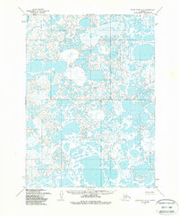
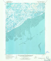
1954 Map of Baird Inlet A-4
USGS Topo · Published 1988About this map
Dall Lake marks the northwestern corner of this 1954 landscape, where an intricate network of unnamed water bodies and marshland dominates the terrain. This survey reflects a period when the Bureau of Land Management used predetermined, unsurveyed locations to establish the Base Line across the central portion of the Baird Inlet region. The area is characterized by low relief and expansive wetlands, captured through photogrammetric methods from aerial photographs taken between 1952 and 1955. Because the map was not field checked, it provides a unique look at the interpretive mapping of the Alaskan wilderness before extensive ground surveys, emphasizing the natural hydrology and the early administrative efforts of the Seward Meridian.
Find a feature on this map
2 named features on this map. Tap any name to fly to it.
Don’t see what you’re looking for? This feature index may not catch every label — zoom into the map to look around manually.
Map Details
Editions of this 1954 Baird Inlet A-4 Map
2 editions found
Other maps of this area

1951 · Kuskokwim Bay
USGS Topo · 1:250,000

1951 · Baird Inlet
USGS Topo · 1:250,000

1953 · Baird Inlet B-5
USGS Topo · 1:63,360
1954 · Baird Inlet A-5
USGS Topo · 1:63,360

1954 · Baird Inlet A-3
USGS Topo · 1:63,360

1954 · Baird Inlet
USGS Topo · 1:250,000

1954 · Kuskokwim Bay
USGS Topo · 1:250,000

1954 · Baird Inlet B-3
USGS Topo · 1:63,360
1954 · Kuskokwim Bay D-4
USGS Topo · 1:63,360
1954 · Kuskokwim Bay D-3
USGS Topo · 1:63,360