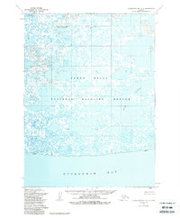
1954 Map of Kuskokwim Bay D-5
USGS Topo · Published 1988About this map
Kuskokwim Bay meets the intricate wetlands of the Yukon Delta on this mid-century survey of the Alaska coastline. The landscape is defined by an expansive network of ponds, marshes, and winding water bodies, including the prominent Kuguklik River and Bow Lake. This area is largely protected within the Yukon Delta National Wildlife Refuge, reflecting the region's importance as a massive, undeveloped river delta ecosystem. For those interested in historical settlement patterns, the map identifies the Chulit (Site) near the coast, indicating former habitation in this remote watery environment. The lack of roads or trails highlights the reliance on water transport and the seasonal rhythms of the delta during the 1950s.
Find a feature on this map
7 named features on this map. Tap any name to fly to it.
Don’t see what you’re looking for? This feature index may not catch every label — zoom into the map to look around manually.
Map Details
Editions of this 1954 Kuskokwim Bay D-5 Map
2 editions found
Other maps of this area

1951 · Kuskokwim Bay
USGS Topo · 1:250,000

1951 · Baird Inlet
USGS Topo · 1:250,000
1954 · Baird Inlet A-5
USGS Topo · 1:63,360

1954 · Baird Inlet
USGS Topo · 1:250,000

1954 · Kuskokwim Bay
USGS Topo · 1:250,000
1954 · Kuskokwim Bay D-6
USGS Topo · 1:63,360
1954 · Kuskokwim Bay D-4
USGS Topo · 1:63,360
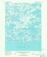
1954 · Kuskokwim Bay D-5
USGS Topo · 1:63,360
1954 · Baird Inlet A-6
USGS Topo · 1:63,360
1954 · Baird Inlet A-4
USGS Topo · 1:63,360