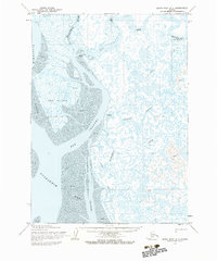
1954 Map of Baird Inlet A-1
USGS Topo · Published 1983About this map
The Eek River meanders through a vast network of tidal flats and marshy lowlands in this mid-century survey of the Yukon-Kuskokwim Delta. Near the river's mouth, the settlement of Eek serves as a focal point for the region, complete with a Cem and a Seaplane Float that highlights the critical importance of bush aviation in rural Alaska. Smaller outposts like Apokak and Kukwak are scattered among the waterways, connected during the colder months by a Winter Trail that cuts across the frozen tundra.
Find a feature on this map
23 named features on this map. Tap any name to fly to it.
Don’t see what you’re looking for? This feature index may not catch every label — zoom into the map to look around manually.
Map Details
Editions of this 1954 Baird Inlet A-1 Map
2 editions found
Other maps of this area

1950 · Bethel
USGS Topo · 1:250,000

1951 · Kuskokwim Bay
USGS Topo · 1:250,000

1951 · Goodnews
USGS Topo · 1:250,000

1951 · Baird Inlet
USGS Topo · 1:250,000
1953 · Kuskokwim Bay D-2
USGS Topo · 1:63,360

1954 · Bethel B-8
USGS Topo · 1:63,360
1954 · Bethel A-8
USGS Topo · 1:63,360

1954 · Baird Inlet
USGS Topo · 1:250,000

1954 · Kuskokwim Bay
USGS Topo · 1:250,000

1954 · Baird Inlet B-1
USGS Topo · 1:63,360