
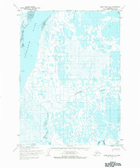
1954 Map of Baird Inlet B-1
USGS Topo · Published 1968About this map
Kuskokwim River dominates the western edge of this subarctic landscape, where tidal flats meet a complex network of meandering waterways. The topography, mapped from 1952 aerial photography, reveals a region defined by its reliance on seasonal movement and traditional subsistence sites. Several small settlements and seasonal locations are documented, including Enhiak, Victor, and Gul, alongside a designated Fishing Camp near the southern boundary. The presence of a Winter Trail in the northeast corner underscores the importance of frozen-ground transport in a terrain otherwise saturated by the Eenayarak River and numerous unnamed ponds. This survey provides a baseline of the mid-century geography before modern shifts in river channels or climate altered the delta’s intricate drainage patterns.
Find a feature on this map
10 named features on this map. Tap any name to fly to it.
Don’t see what you’re looking for? This feature index may not catch every label — zoom into the map to look around manually.
Map Details
Editions of this 1954 Baird Inlet B-1 Map
2 editions found
Other maps of this area

1950 · Bethel
USGS Topo · 1:250,000

1951 · Baird Inlet
USGS Topo · 1:250,000

1954 · Bethel B-8
USGS Topo · 1:63,360

1954 · Bethel C-8
USGS Topo · 1:63,360
1954 · Bethel A-8
USGS Topo · 1:63,360

1954 · Baird Inlet
USGS Topo · 1:250,000
1954 · Baird Inlet A-1
USGS Topo · 1:63,360
1954 · Baird Inlet C-1
USGS Topo · 1:63,360
1954 · Baird Inlet C-2
USGS Topo · 1:63,360
1954 · Baird Inlet A-2
USGS Topo · 1:63,360