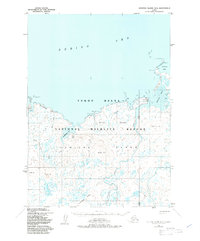
1952 Map of Nunivak Island B-4
USGS Topo · Published 1984About this map
Mekoryuk serves as the primary coastal settlement on this portion of Nunivak Island, situated where the Mekoryuk River meets the Bering Sea. The landscape is dominated by the Yukon Delta National Wildlife Refuge, characterized by a complex network of coastal features including Shoal Bay and the prominent Cape Etolin. Inland, the terrain rises into the Kimikthak Hills and Ingrijoak Hills, while several named high points like Kiolik Hill and Ingriruk Hill punctuate the tundra.
Find a feature on this map
24 named features on this map. Tap any name to fly to it.
Don’t see what you’re looking for? This feature index may not catch every label — zoom into the map to look around manually.
Map Details
Editions of this 1952 Nunivak Island B-4 Map
2 editions found
Other maps of this area

1951 · Nunivak Island
USGS Topo · 1:250,000

1952 · Nunivak Island A-4
USGS Topo · 1:63,360

1952 · Nunivak Island A-5
USGS Topo · 1:63,360

1952 · Nunivak Island A-3
USGS Topo · 1:63,360
1952 · Nunivak Island B-5
USGS Topo · 1:63,360
1952 · Nunivak Island B-3
USGS Topo · 1:63,360
1952 · Nunivak Island B-4
USGS Topo · 1:63,360

1954 · Nunivak Island
USGS Topo · 1:250,000

1958 · Nunivak Island
USGS Topo · 1:250,000

1964 · Nunivak Island
USGS Topo · 1:250,000