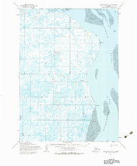
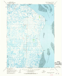
1954 Map of Baird Inlet A-2
USGS Topo · Published 1983About this map
Kuskokwim Bay and the intricate delta lands of southwest Alaska dominate this mid-century survey, revealing a landscape defined by shifting water and seasonal movement. The transition from the Kuskokwim River to the tidal flats is marked by extensive areas of mud and sand near West Point. This document is particularly valuable for documenting indigenous and seasonal land use, noting locations such as Popokamiut and several sites including Kuskovak (Site) and Papka (Site). The interior is a complex network of wetlands drained by the Tagayarak River and the Ishkowik River. A Winter Trail cuts across the northern landscape, illustrating the critical transportation corridors that emerged when the tundra froze. Smaller named localities like Snooks and Bivouac provide evidence of specific camps or points of interest within this labyrinth of lakes and sloughs.
Find a feature on this map
14 named features on this map. Tap any name to fly to it.
Don’t see what you’re looking for? This feature index may not catch every label — zoom into the map to look around manually.
Map Details
Editions of this 1954 Baird Inlet A-2 Map
2 editions found
Other maps of this area

1951 · Kuskokwim Bay
USGS Topo · 1:250,000

1951 · Baird Inlet
USGS Topo · 1:250,000
1953 · Kuskokwim Bay D-2
USGS Topo · 1:63,360

1954 · Baird Inlet A-3
USGS Topo · 1:63,360

1954 · Baird Inlet
USGS Topo · 1:250,000

1954 · Kuskokwim Bay
USGS Topo · 1:250,000

1954 · Baird Inlet B-1
USGS Topo · 1:63,360
1954 · Baird Inlet A-1
USGS Topo · 1:63,360
1954 · Kuskokwim Bay D-1
USGS Topo · 1:63,360
1954 · Baird Inlet A-2
USGS Topo · 1:63,360