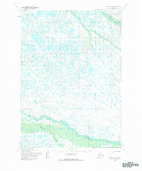
1954 Map of Bethel D-5
USGS Topo · Published 1983About this map
The Tuluksak River and Fog River wind through this tundra landscape, characterized by a complex network of thousands of small lakes and ponds. This 1954 fieldwork, updated with late-1950s aerial photography, documents a region defined by its seasonal mobility and water-bound geography. In the northern reaches, a Winter Trail cuts across the basin, providing a vital overland connection through the marshy interior during the frozen months. To the south, the Kisaralik River and its tributary, the Kasigluk River, dominate the drainage pattern. The map reveals an unsurveyed wilderness where land lines remained predetermined by the Bureau of Land Management rather than established on the ground, reflecting the area's status as a remote frontier where transportation relied heavily on the river systems and temporary winter routes.
Find a feature on this map
5 named features on this map. Tap any name to fly to it.
Don’t see what you’re looking for? This feature index may not catch every label — zoom into the map to look around manually.
Map Details
Editions of this 1954 Bethel D-5 Map
2 editions found

Other maps of this area

1947 · Russian Mission
USGS Topo · 1:250,000

1950 · Russian Mission
USGS Topo · 1:250,000

1950 · Bethel
USGS Topo · 1:250,000

1954 · Russian Mission A-4
USGS Topo · 1:63,360

1954 · Russian Mission A-6
USGS Topo · 1:63,360

1954 · Russian Mission A-5
USGS Topo · 1:63,360

1954 · Bethel D-4
USGS Topo · 1:63,360

1954 · Bethel C-6
USGS Topo · 1:63,360

1954 · Bethel C-5
USGS Topo · 1:63,360

1954 · Bethel D-6
USGS Topo · 1:63,360