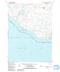
1952 Map of Cape Mendenhall D-5
USGS Topo · Published 1992About this map
Nunivak Island is depicted here along the southern shoreline of the Bering Sea, showing a landscape of dunes and volcanic hills as it was recorded in the mid-20th century. This area, largely defined by the Nunivak Wilderness and the Yukon Delta National Wildlife Refuge, remains a critical intersection of indigenous seasonal land use and federal conservation. Of particular note for local historians and researchers are the labeled indigenous sites, including Chakwakamiut (Summer Camp) near the mouth of the Chakwakamiut River and the Binajoaksmiut (Site) located further east at Boulder Beach. The drainage patterns of the Jayalik River and the elevation of Binat-ingrat Hill provide a clear view of the island's unique topography, where hydrology and traditional subsistence locations are closely linked.
Find a feature on this map
14 named features on this map. Tap any name to fly to it.
Don’t see what you’re looking for? This feature index may not catch every label — zoom into the map to look around manually.
Map Details
Editions of this 1952 Cape Mendenhall D-5 Map
3 editions found
Other maps of this area

1951 · Cape Mendenhall
USGS Topo · 1:250,000

1951 · Nunivak Island
USGS Topo · 1:250,000

1952 · Cape Mendenhall D-4
USGS Topo · 1:63,360

1952 · Nunivak Island A-4
USGS Topo · 1:63,360

1952 · Cape Mendenhall
USGS Topo · 1:250,000

1952 · Cape Mendenhall D-6
USGS Topo · 1:63,360

1952 · Nunivak Island A-6
USGS Topo · 1:63,360

1952 · Nunivak Island A-5
USGS Topo · 1:63,360
1952 · Cape Mendenhall D-5
USGS Topo · 1:63,360

1954 · Nunivak Island
USGS Topo · 1:250,000