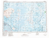
1954 Map of Baird Inlet
USGS Topo · Published 1983About this map
The Yukon Delta National Wildlife Refuge encompasses a vast hydrographic network of the Yukon-Kuskokwim Delta, where the Baird Inlet meets the Bering Sea. This mid-century landscape is defined by its complex waterway system, including the Ninglick River and the meandering Kuskokwim River. Indigenous settlements and subsistence sites are documented throughout the marshy tundra, ranging from established villages like Newtok and Chefornak to numerous seasonal locations such as Nunakak Camp and Chiloghunut.
Find a feature on this map
80 named features on this map. Tap any name to fly to it.
Don’t see what you’re looking for? This feature index may not catch every label — zoom into the map to look around manually.
Map Details
Editions of this 1954 Baird Inlet Map
3 editions found

Other maps of this area

1947 · Russian Mission
USGS Topo · 1:250,000

1950 · Russian Mission
USGS Topo · 1:250,000

1950 · Bethel
USGS Topo · 1:250,000

1951 · Marshall
USGS Topo · 1:250,000

1951 · Kuskokwim Bay
USGS Topo · 1:250,000

1951 · Hooper Bay
USGS Topo · 1:250,000

1951 · Cape Mendenhall
USGS Topo · 1:250,000

1951 · Nunivak Island
USGS Topo · 1:250,000

1951 · Goodnews
USGS Topo · 1:250,000

1951 · Baird Inlet
USGS Topo · 1:250,000