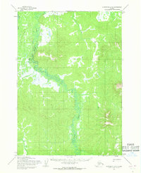
1954 Map of Sleetmute A-3
USGS Topo · Published 1968About this map
The Holitna River meanders through this portion of the Alaska interior, its banks surrounded by complex marshlands and dense contour intervals that define the regional elevation. Surveyed in the mid-1950s, the landscape is almost entirely defined by its waterways, most notably the winding course of Titnuk Creek as it flows through the central and southern sections of the quadrangle. Human presence is limited to rudimentary transportation routes, including a designated Trail and a specialized Tractor route in the northwest corner, likely used for remote access or resource exploration. The map reflects a period when large portions of the territory remained unsurveyed and unmarked on the ground, with land lines predetermined by the Bureau of Land Management rather than through physical field checking.
Find a feature on this map
4 named features on this map. Tap any name to fly to it.
Don’t see what you’re looking for? This feature index may not catch every label — zoom into the map to look around manually.
Map Details
Editions of this 1954 Sleetmute A-3 Map
This is the sole edition of this map. No revisions or reprints were ever made.
Other maps of this area

1950 · Sleetmute
USGS Topo · 1:250,000

1950 · Taylor Mountains
USGS Topo · 1:250,000

1951 · Taylor Mountains
USGS Topo · 1:250,000

1954 · Sleetmute
USGS Topo · 1:250,000

1954 · Taylor Mountains
USGS Topo · 1:250,000

1954 · Sleetmute B-2
USGS Topo · 1:63,360
1954 · Taylor Mountains D-3
USGS Topo · 1:63,360

1954 · Sleetmute B-3
USGS Topo · 1:63,360

1954 · Sleetmute B-4
USGS Topo · 1:63,360

1954 · Taylor Mountains D-2
USGS Topo · 1:63,360