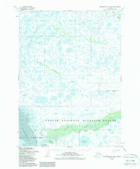
1954 Map of Goodnews Bay D-8
USGS Topo · Published 1988About this map
Quinhagak sits at the confluence of the Kanektok River and the eastern shore of Kuskokwim Bay, serving as a primary settlement in this coastal delta landscape. This mid-century survey by the Defense Mapping Agency captures the region just as it was being integrated into federal conservation efforts, with the Togiak National Wildlife Refuge boundary established across the southern reach. The hydrology is dominated by intricate drainage systems, including the North Branch and South Branch Warehouse Creek, which snake through a low-lying terrain of lakes and tidal flats. Evidence of seasonal travel and remote access is documented through the Winter Trail and a designated Landing Strip near the coast. Smaller waterways like Weelung Creek and Ithagsutlek Lake reflect the complex aquatic network essential to the area's subsistence and transport patterns before modern infrastructure arrived.
Find a feature on this map
20 named features on this map. Tap any name to fly to it.
Don’t see what you’re looking for? This feature index may not catch every label — zoom into the map to look around manually.
Map Details
Editions of this 1954 Goodnews Bay D-8 Map
2 editions found
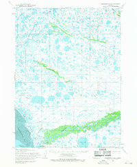
Other maps of this area

1950 · Bethel
USGS Topo · 1:250,000

1951 · Kuskokwim Bay
USGS Topo · 1:250,000

1951 · Goodnews
USGS Topo · 1:250,000

1951 · Baird Inlet
USGS Topo · 1:250,000
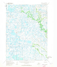
1954 · Bethel A-8
USGS Topo · 1:63,360

1954 · Bethel A-7
USGS Topo · 1:63,360

1954 · Baird Inlet
USGS Topo · 1:250,000

1954 · Kuskokwim Bay
USGS Topo · 1:250,000

1954 · Goodnews C-7
USGS Topo · 1:63,360

1954 · Goodnews D-7
USGS Topo · 1:63,360