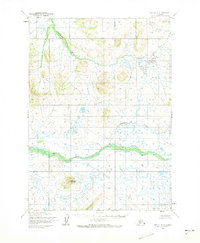
1954 Map of Bethel B-5
USGS Topo · Published 1973About this map
Kwethluk River meanders across this interior Alaskan landscape, defining the hydrology of a region dominated by intricate water systems and isolated peaks. During the mid-1950s, the Army Map Service and U.S. Geological Survey documented this terrain, which remains largely devoid of roads or permanent settlements. The map illustrates a complex network of tundra streams, including the Akulikutak River and Johnson Creek, which feed into the larger river systems. A significant landmark in the southern portion of the quadrangle is Eluwaktak Mountain, standing as a prominent topographic feature amidst the surrounding low-lying wetlands. Other notable water bodies such as Coral Creek and L Kasigluk R further demonstrate the saturated nature of the local geography. This survey captures a moment when the Seward Meridian land lines were largely unsurveyed, representing a vast area of the Yukon-Kuskokwim Delta region in its natural state.
Find a feature on this map
6 named features on this map. Tap any name to fly to it.
Don’t see what you’re looking for? This feature index may not catch every label — zoom into the map to look around manually.
Map Details
Editions of this 1954 Bethel B-5 Map
2 editions found
Other maps of this area

1950 · Bethel
USGS Topo · 1:250,000

1954 · Bethel B-6
USGS Topo · 1:63,360

1954 · Bethel C-6
USGS Topo · 1:63,360

1954 · Bethel C-5
USGS Topo · 1:63,360

1954 · Bethel C-4
USGS Topo · 1:63,360

1954 · Bethel A-5
USGS Topo · 1:63,360

1954 · Bethel A-4
USGS Topo · 1:63,360

1954 · Bethel B-4
USGS Topo · 1:63,360

1954 · Bethel B-5
USGS Topo · 1:63,360

1954 · Bethel A-6
USGS Topo · 1:63,360