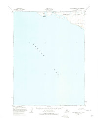
1952 Map of Cape Mendenhall D-6
USGS Topo · Published 1975About this map
Nunivak Island meets the cold expanse of the Bering Sea along this coastal stretch, where seasonal subsistence patterns are recorded in the topography of the early 1950s. The map identifies specific summer camps including Dahloongamiut and Kiyakyaliksamiut, settlements that reflect the traditional land use of the Cup'ig people. These camps are strategically positioned near freshwater and marine resources, with Dahloongamiut Lagoon and the Kiyakyaliksamiut River providing vital access to the interior and coastal environments. The coastal boundary is further defined by the wide expanse of Sand Beach, showing the transition from the volcanic island terrain to the shoreline. This survey, based on 1950 and 1952 aerial photography, preserves the nomenclature of a specific era of indigenous habitation and geographic naming on the island.
Find a feature on this map
8 named features on this map. Tap any name to fly to it.
Don’t see what you’re looking for? This feature index may not catch every label — zoom into the map to look around manually.
Map Details
Editions of this 1952 Cape Mendenhall D-6 Map
2 editions found
Other maps of this area

1951 · Cape Mendenhall
USGS Topo · 1:250,000

1951 · Nunivak Island
USGS Topo · 1:250,000

1952 · Nunivak Island A-7
USGS Topo · 1:63,360

1952 · Cape Mendenhall
USGS Topo · 1:250,000

1952 · Cape Mendenhall D-6
USGS Topo · 1:63,360

1952 · Nunivak Island A-6
USGS Topo · 1:63,360

1952 · Nunivak Island A-5
USGS Topo · 1:63,360
1952 · Cape Mendenhall D-5
USGS Topo · 1:63,360

1954 · Nunivak Island
USGS Topo · 1:250,000

1958 · Nunivak Island
USGS Topo · 1:250,000