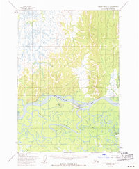
1952 Map of Russian Mission C-2
USGS Topo · Published 1971About this map
The Aniak settlement serves as the focal point of this 1952 topographic survey, positioned at the confluence where the Aniak River meets the expansive Kuskokwim River. This region of the Alaska interior is defined by a complex network of waterways, including the winding Aniak Slough and the Owhat River, which carve through the landscape of the Seward Meridian. The geography indicates a reliance on river and air transport, as evidenced by the Seaplane Base, Landing Strip, and Beacon located near the town center.
Find a feature on this map
17 named features on this map. Tap any name to fly to it.
Don’t see what you’re looking for? This feature index may not catch every label — zoom into the map to look around manually.
Map Details
Editions of this 1952 Russian Mission C-2 Map
2 editions found
Other maps of this area

1947 · Russian Mission
USGS Topo · 1:250,000

1950 · Russian Mission
USGS Topo · 1:250,000

1952 · Russian Mission D-2
USGS Topo · 1:63,360

1952 · Russian Mission C-1
USGS Topo · 1:63,360

1952 · Russian Mission D-1
USGS Topo · 1:63,360

1952 · Russian Mission D-3
USGS Topo · 1:63,360

1952 · Russian Mission C-3
USGS Topo · 1:63,360

1952 · Russian Mission C-2
USGS Topo · 1:63,360

1952 · Russian Mission B-2
USGS Topo · 1:63,360

1952 · Russian Mission B-3
USGS Topo · 1:63,360