
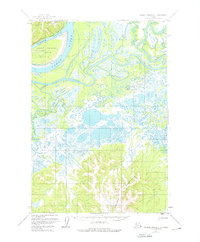
1952 Map of Russian Mission D-3
USGS Topo · Published 1960About this map
Paimiut sits on the banks of the Yukon River at a point where the massive waterway splits into a complex network of channels and backwaters. This 1952 field-annotated survey documents a landscape dominated by the river's hydrology, featuring Summer Slough and Paimiut Slough which wrap around the significant landmass of Great Paimiut Island. To the north and south, the terrain rises sharply into the Paimiut Hills and the Portage Mountains, providing a stark topographical contrast to the marshy lowlands of the river valley. A notable overland route, the Winter Trail, cuts across the northern landscape near Tabernacle Mtn, indicating the vital seasonal transportation patterns of the Alaska Interior during the mid-20th century before more permanent infrastructure reached this region.
Find a feature on this map
9 named features on this map. Tap any name to fly to it.
Don’t see what you’re looking for? This feature index may not catch every label — zoom into the map to look around manually.
Map Details
Editions of this 1952 Russian Mission D-3 Map
2 editions found
Other maps of this area

1947 · Russian Mission
USGS Topo · 1:250,000

1950 · Russian Mission
USGS Topo · 1:250,000

1951 · Holy Cross
USGS Topo · 1:250,000

1952 · Holy Cross A-2
USGS Topo · 1:63,360

1952 · Holy Cross A-3
USGS Topo · 1:63,360

1952 · Russian Mission D-2
USGS Topo · 1:63,360

1952 · Holy Cross
USGS Topo · 1:250,000

1952 · Russian Mission C-3
USGS Topo · 1:63,360

1952 · Russian Mission C-2
USGS Topo · 1:63,360

1952 · Russian Mission D-4
USGS Topo · 1:63,360