
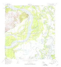
1952 Map of Holy Cross A-2
USGS Topo · Published 1959About this map
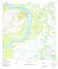
The Holy Cross Hills rise prominently over the confluence of the Yukon River and its intricate network of side-channels in this mid-century sub-arctic landscape. The settlement of Holy Cross sits at the foot of these hills, positioned along Walker Slough, while several cabins are scattered across the low-lying river islands. The map documents a complex aquatic geography defined by the winding Innoko River and a labyrinth of secondary waterways such as Red Wing Slough and Big Bend Slough. Movement through this interior region during the early 1950s relied heavily on seasonal routes, evidenced by the Winter Trail that cuts across the frozen wetlands north of Railroad City. Survey control points like VABM Paimut and VABM Holy Cross mark the triangulation efforts used to map this shifting landscape of silt and water.
Find a feature on this map
26 named features on this map. Tap any name to fly to it.
Don’t see what you’re looking for? This feature index may not catch every label — zoom into the map to look around manually.
Map Details
Editions of this 1952 Holy Cross A-2 Map
3 editions found
Other maps of this area

1947 · Russian Mission
USGS Topo · 1:250,000

1950 · Russian Mission
USGS Topo · 1:250,000

1951 · Holy Cross
USGS Topo · 1:250,000

1952 · Holy Cross B-2
USGS Topo · 1:63,360

1952 · Holy Cross A-1
USGS Topo · 1:63,360

1952 · Holy Cross B-3
USGS Topo · 1:63,360

1952 · Holy Cross B-1
USGS Topo · 1:63,360

1952 · Holy Cross A-3
USGS Topo · 1:63,360

1952 · Russian Mission D-2
USGS Topo · 1:63,360

1952 · Holy Cross
USGS Topo · 1:250,000