
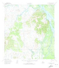
1952 Map of Holy Cross B-3
USGS Topo · Published 1959About this map
Bonasila River drainage and the mighty Yukon River dominate this interior Alaska landscape, captured during a period of active resource exploration in the early 1950s. The settlement at Paradise sits along the eastern bank of the Yukon, positioned across from Carlo Island in a region defined by complex seasonal waterways. The industrial footprint of the era is anchored by the Bonasila Mine, located near the confluence of the river and Bonasila Slough. Low-lying wetlands and intricate drainage patterns like Deer Hunting Slough contrast with the higher ground where a Winter Trail provided essential overland passage. The presence of the Koserefski River further illustrates the dense network of tributaries that supported both subsistence and commercial interests in this remote territory.
Find a feature on this map
12 named features on this map. Tap any name to fly to it.
Don’t see what you’re looking for? This feature index may not catch every label — zoom into the map to look around manually.
Map Details
Editions of this 1952 Holy Cross B-3 Map
2 editions found
Other maps of this area

1951 · Holy Cross
USGS Topo · 1:250,000

1952 · Holy Cross B-2
USGS Topo · 1:63,360

1952 · Holy Cross A-2
USGS Topo · 1:63,360

1952 · Holy Cross A-4
USGS Topo · 1:63,360

1952 · Holy Cross C-2
USGS Topo · 1:63,360

1952 · Holy Cross C-3
USGS Topo · 1:63,360

1952 · Holy Cross A-3
USGS Topo · 1:63,360

1952 · Holy Cross C-4
USGS Topo · 1:63,360

1952 · Holy Cross B-4
USGS Topo · 1:63,360

1952 · Holy Cross
USGS Topo · 1:250,000