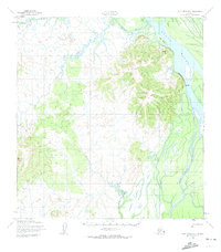
1952 Map of Holy Cross B-3
USGS Topo · Published 1974About this map
The Yukon River dominates the eastern edge of this landscape, carving a wide path through the Alaskan interior during the early 1950s. West of the river, a complex network of waterways including the Bonasila River and Koserefski River creates a maze of sloughs and floodplains. The small settlement of Paradise sits along the Yukon’s bank, while the land rises sharply to the west toward the prominent Bonasila Dome.
Find a feature on this map
14 named features on this map. Tap any name to fly to it.
Don’t see what you’re looking for? This feature index may not catch every label — zoom into the map to look around manually.
Map Details
Editions of this 1952 Holy Cross B-3 Map
2 editions found
Other maps of this area

1951 · Holy Cross
USGS Topo · 1:250,000

1952 · Holy Cross B-2
USGS Topo · 1:63,360

1952 · Holy Cross A-2
USGS Topo · 1:63,360

1952 · Holy Cross A-4
USGS Topo · 1:63,360

1952 · Holy Cross C-2
USGS Topo · 1:63,360

1952 · Holy Cross B-3
USGS Topo · 1:63,360

1952 · Holy Cross C-3
USGS Topo · 1:63,360

1952 · Holy Cross A-3
USGS Topo · 1:63,360

1952 · Holy Cross C-4
USGS Topo · 1:63,360

1952 · Holy Cross B-4
USGS Topo · 1:63,360