
1952 Map of Russian Mission C-2
USGS Topo · Published 1960About this map
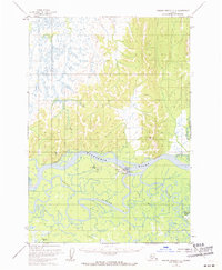
Aniak serves as the central hub on this Alaskan landscape, situated at a strategic bend where the Kuskokwim River meets a complex network of waterways. The settlement's infrastructure in the early 1950s is defined by its Airstrip, a Beacon, and Radio Towers, highlighting the critical role of aviation and communication in this interior region. The surrounding terrain is a labyrinth of seasonal paths and active water routes, including the Winter Trail and the meandering Aniak Slough. South and east of the main channel, the Owhat River and Doestock Creek drain through a dense landscape of ponds and marshes, illustrating the dynamic hydrology of the Kuskokwim basin. This survey captures a moment of mid-century development where traditional river travel and overland winter routes began to intersect with permanent aeronautical facilities.
Find a feature on this map
13 named features on this map. Tap any name to fly to it.
Don’t see what you’re looking for? This feature index may not catch every label — zoom into the map to look around manually.
Map Details
Editions of this 1952 Russian Mission C-2 Map
2 editions found
Other maps of this area

1947 · Russian Mission
USGS Topo · 1:250,000

1950 · Russian Mission
USGS Topo · 1:250,000

1952 · Russian Mission D-2
USGS Topo · 1:63,360

1952 · Russian Mission C-1
USGS Topo · 1:63,360

1952 · Russian Mission D-1
USGS Topo · 1:63,360

1952 · Russian Mission D-3
USGS Topo · 1:63,360

1952 · Russian Mission C-3
USGS Topo · 1:63,360

1952 · Russian Mission B-2
USGS Topo · 1:63,360

1952 · Russian Mission B-3
USGS Topo · 1:63,360
1952 · Russian Mission B-1
USGS Topo · 1:63,360