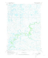
1954 Map of Marshall B-4
USGS Topo · Published 1973About this map
Izaviknek River snakes through a dense network of lakes and marshes in this mid-century portrait of the Alaskan interior. Mapped by the Army Map Service from 1951 aerial photography, the landscape is defined by its complex hydrology and the absence of established roads or trails. The primary watercourses, including Chakaktolik Creek and Kuka Creek, serve as the defining landmarks across a terrain where land lines remained unsurveyed and unmarked by the Bureau of Land Management at the time of the 1954 field annotation. This map documents a period of early photogrammetric surveying in Alaska, capturing the intricate shoreline patterns of countless nameless ponds and wetlands before later environmental shifts or administrative changes altered the record of this specific subarctic wilderness.
Find a feature on this map
3 named features on this map. Tap any name to fly to it.
Don’t see what you’re looking for? This feature index may not catch every label — zoom into the map to look around manually.
Map Details
Editions of this 1954 Marshall B-4 Map
2 editions found
Other maps of this area

1951 · Marshall
USGS Topo · 1:250,000

1952 · Marshall C-5
USGS Topo · 1:63,360
1953 · Marshall A-5
USGS Topo · 1:63,360

1953 · Marshall B-5
USGS Topo · 1:63,360

1954 · Marshall B-4
USGS Topo · 1:63,360

1954 · Marshall C-3
USGS Topo · 1:63,360

1954 · Marshall B-3
USGS Topo · 1:63,360

1954 · Marshall A-3
USGS Topo · 1:63,360

1954 · Marshall C-4
USGS Topo · 1:63,360
1954 · Marshall A-4
USGS Topo · 1:63,360