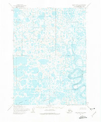
1954 Map of Baird Inlet A-3
USGS Topo · Published 1977About this map
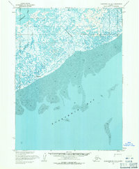
Ishkowik River meanders across this low-lying coastal landscape of western Alaska, where the delta environment is defined by an intricate network of unnamed ponds and marshes. The hydrological complexity is striking, featuring the braided path of the Kongnignanohk River and the significant basin of Kolekfikpuk Lake in the southwest corner. The absence of roads or established trails on this 1950s survey highlights the remote character of the Bethel region during this era. A single Shelter located along the eastern bends of the Ishkowik River serves as the only named man-made point of interest, likely indicating a vital waypoint for subsistence hunters or travelers navigating the waterways before the widespread use of modern navigation. Broad areas of Sand Mud are identified along the river banks, reflecting the seasonal shifts and sedimentary nature of the region's massive drainage systems.
Find a feature on this map
6 named features on this map. Tap any name to fly to it.
Don’t see what you’re looking for? This feature index may not catch every label — zoom into the map to look around manually.
Map Details
Editions of this 1954 Baird Inlet A-3 Map
2 editions found
Other maps of this area

1951 · Kuskokwim Bay
USGS Topo · 1:250,000

1951 · Baird Inlet
USGS Topo · 1:250,000
1953 · Kuskokwim Bay D-2
USGS Topo · 1:63,360

1954 · Baird Inlet A-3
USGS Topo · 1:63,360

1954 · Baird Inlet
USGS Topo · 1:250,000

1954 · Kuskokwim Bay
USGS Topo · 1:250,000
1954 · Baird Inlet A-2
USGS Topo · 1:63,360

1954 · Baird Inlet B-3
USGS Topo · 1:63,360
1954 · Kuskokwim Bay D-4
USGS Topo · 1:63,360
1954 · Kuskokwim Bay D-3
USGS Topo · 1:63,360