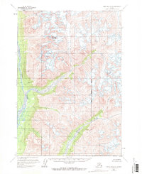
1958 Map of Lime Hills B-2
USGS Topo · Published 1971About this map
Snowcap Mountain dominates the high-altitude topography of this interior landscape, marking a terrain of significant glaciation and vertical relief. Surveyed in the late 1950s, the map reveals a wilderness where the Kenai Peninsula Borough boundary meets an environment defined by the Stony River and the Necons River. These waterways carve through deep valleys between high peaks, their paths often influenced by the active glacial features above. Numerous areas of crevasses are explicitly marked, indicating the presence of living glaciers that shaped the drainage basins. This 1:63,360 scale study, derived from aerial photography, illustrates a remote region void of roads or permanent settlements at the time of the survey, documenting the raw hydrography of the Alaska Range before modern developmental pressures.
Find a feature on this map
5 named features on this map. Tap any name to fly to it.
Don’t see what you’re looking for? This feature index may not catch every label — zoom into the map to look around manually.
Map Details
Editions of this 1958 Lime Hills B-2 Map
2 editions found
Other maps of this area

1951 · Lime Hills
USGS Topo · 1:250,000

1954 · Lime Hills A-3
USGS Topo · 1:63,360

1954 · Lime Hills B-3
USGS Topo · 1:63,360

1958 · Lime Hills A-2
USGS Topo · 1:63,360

1958 · Lime Hills C-3
USGS Topo · 1:63,360

1958 · Lime Hills B-1
USGS Topo · 1:63,360
1958 · Lime Hills A-1
USGS Topo · 1:63,360

1958 · Lime Hills C-1
USGS Topo · 1:63,360

1958 · Lime Hills C-2
USGS Topo · 1:63,360
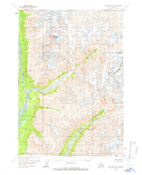
1958 · Lime Hills B-2
USGS Topo · 1:63,360