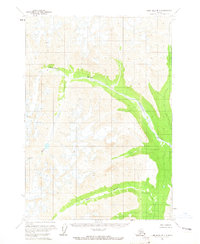
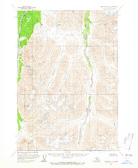
1958 Map of Lime Hills B-1
USGS Topo · Published 1965About this map
Glacial action and high-altitude water systems define this interior Alaskan landscape, dominated by the sweeping course of the Chilligan River. This 1950s survey, compiled from aerial photography, illustrates a complex alpine environment where the Necons River and Igitna River carve through steep terrain. The presence of numerous crevasses across the higher elevations indicates the active glacial nature of the region during this period. With no roads or trails recorded, the map reflects a purely natural state of the Alaskan wilderness, focusing on the hydraulic patterns and topographical relief of the Lime Hills region. This document serves as a baseline for understanding the drainage and ice formations of this area before later environmental shifts.
Find a feature on this map
4 named features on this map. Tap any name to fly to it.
Don’t see what you’re looking for? This feature index may not catch every label — zoom into the map to look around manually.
Map Details
Editions of this 1958 Lime Hills B-1 Map
2 editions found

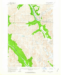
Other maps of this area

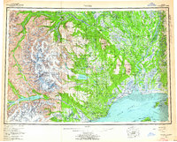
1949 · Tyonek
USGS Topo · 1:250,000

1951 · Tyonek
USGS Topo · 1:250,000
1951 · Lime Hills
USGS Topo · 1:250,000
1958 · Tyonek B-8
USGS Topo · 1:63,360
1958 · Tyonek C-8
USGS Topo · 1:63,360
1958 · Tyonek
USGS Topo · 1:250,000

1958 · Lime Hills A-2
USGS Topo · 1:63,360
1958 · Tyonek A-8
USGS Topo · 1:63,360
1958 · Lime Hills A-1
USGS Topo · 1:63,360
1958 · Lime Hills C-1
USGS Topo · 1:63,360