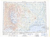
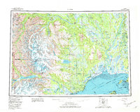
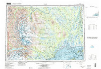
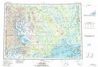
1958 Map of Tyonek
USGS Topo · Published 1964About this map
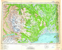
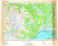
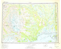
Mount Spurr and the glaciated peaks of the Tordrillo Mountains dominate the western horizon of this survey, where massive ice fields like Triumvirate Glacier and Hayes Glacier feed the river systems of the western Cook Inlet. The landscape transitions from the high peaks of the Alaska Range down to the sprawling Susitna Flats and the marshes of Trading Bay. Native heritage and early coastal settlements are well-represented, including the Moquawkie Indian Reservation and the village of Tyonek, alongside the site of Old Tyonek. To the north, the confluence of the Yentna River and Susitna River highlights a water-based transport network essential for communities such as McDougall and Susitna. The map also traces the path of the Alaska Railroad and the Winter Trail, documenting the vital overland corridors connecting the coastal inlets to the interior during the mid-20th century.
Find a feature on this map
83 named features on this map. Tap any name to fly to it.
Don’t see what you’re looking for? This feature index may not catch every label — zoom into the map to look around manually.
Map Details
Editions of this 1958 Tyonek Map
6 editions found
Historical Maps of Willow Through Time
4 maps found