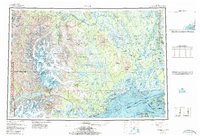
1958 Map of Tyonek
USGS Topo · Published 1986About this map
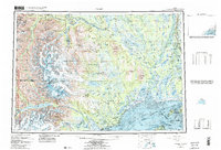
The Skwentna River and the massive Susitna River dominate this mid-century look at the upper Cook Inlet region, revealing a landscape defined by glacial networks and riverine settlements. This 1:250,000 scale survey captures the area during a period of transition, showing the Alaska Railroad corridor passing through eastern settlements like Willow and Kashwitna while the western interior remains accessible primarily via waterways or the Winter Trail. High-elevation landmarks such as Mount Spurr and Mount Torbert in the Tordrillo Mountains contrast with the low-lying coastal marshes near Old Tyonek and the Susitna Flats. The inclusion of bathymetric data within Cook Inlet and along the Knik Arm provides a rare look at the underwater topography of these treacherous glacial waters, alongside coastal settlements like Tyonek and Ladd.
Find a feature on this map
62 named features on this map. Tap any name to fly to it.
Don’t see what you’re looking for? This feature index may not catch every label — zoom into the map to look around manually.
Map Details
Editions of this 1958 Tyonek Map
6 editions found

Other maps of this area

1944 · Kenai
USGS Topo · 1:250,000

1946 · Lake Clark
USGS Topo · 1:250,000

1949 · Tyonek
USGS Topo · 1:250,000

1949 · McGrath
USGS Topo · 1:250,000

1949 · Anchorage D-8
USGS Topo · 1:63,360

1950 · Kenai
USGS Topo · 1:250,000

1950 · McGrath
USGS Topo · 1:250,000

1950 · Talkeetna Mountains
USGS Topo · 1:250,000

1950 · Talkeetna
USGS Topo · 1:250,000

1950 · Anchorage C-8
USGS Topo · 1:63,360