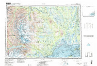
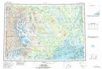
1958 Map of Tyonek
USGS Topo · Published 1986About this map
The Tordrillo Mountains and their massive ice fields dominate the western landscape of this mid-century survey, where the Triumvirate Glacier and Capps Glacier feed into the complex drainage systems of the Chakachatna River and Beluga River. This region represents a critical crossroads of Alaskan transport and industry before the modern era of rapid development. Along the western shores of Cook Inlet, the Dena'ina settlements of Tyonek and Old Tyonek stand near the Beluga coal fields and early energy infrastructure, including a Pipeline and Drill Hole. To the east, the Susitna River creates a sprawling delta at the Susitna Flats, a landscape defined by seasonal change and river navigation. Traces of the historic Iditarod Trail are visible in the northern reaches near the Skwentna River, while the Alaska Railroad and the Nancy Lake State Recreation Area mark the early recreational and industrial corridors of the Matanuska-Susitna Borough.
Find a feature on this map
144 named features on this map. Tap any name to fly to it.
Don’t see what you’re looking for? This feature index may not catch every label — zoom into the map to look around manually.
Map Details
Editions of this 1958 Tyonek Map
6 editions found

Other maps of this area

1944 · Kenai
USGS Topo · 1:250,000

1946 · Lake Clark
USGS Topo · 1:250,000

1949 · Tyonek
USGS Topo · 1:250,000

1949 · McGrath
USGS Topo · 1:250,000

1949 · Anchorage D-8
USGS Topo · 1:63,360

1950 · Kenai
USGS Topo · 1:250,000

1950 · McGrath
USGS Topo · 1:250,000

1950 · Talkeetna Mountains
USGS Topo · 1:250,000

1950 · Talkeetna
USGS Topo · 1:250,000

1950 · Anchorage C-8
USGS Topo · 1:63,360