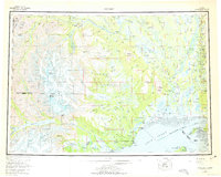
1958 Map of Tyonek
USGS Topo · Published 1975About this map
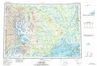
Tyonek and the Tyonek Indian Reservation anchor the western shore of Cook Inlet in this mid-century portrait of Southcentral Alaska. The landscape transition is stark, moving from the glacial mass of the Tordrillo Mountains and volcanic Mount Spurr to the expansive Susitna Flats and the complex river systems of the Skwentna River and Yentna River. Historic settlements and points of interest such as Ladd, Alexander, and the McDougall (Site) are mapped alongside vital transport infrastructure like the Landing Strip and various winter trails. This survey captures a specific era of development, noting the Fort Richardson Military Reservation and the burgeoning Nancy Lake State Recreation Area as the region balanced conservation, indigenous land use, and growing infrastructure near the head of the inlet.
Find a feature on this map
210 named features on this map. Tap any name to fly to it.
Don’t see what you’re looking for? This feature index may not catch every label — zoom into the map to look around manually.
Map Details
Editions of this 1958 Tyonek Map
6 editions found

Other maps of this area

1944 · Kenai
USGS Topo · 1:250,000

1946 · Lake Clark
USGS Topo · 1:250,000

1949 · Tyonek
USGS Topo · 1:250,000

1949 · McGrath
USGS Topo · 1:250,000

1949 · Anchorage D-8
USGS Topo · 1:63,360

1950 · Kenai
USGS Topo · 1:250,000

1950 · McGrath
USGS Topo · 1:250,000

1950 · Talkeetna Mountains
USGS Topo · 1:250,000

1950 · Talkeetna
USGS Topo · 1:250,000

1950 · Anchorage C-8
USGS Topo · 1:63,360