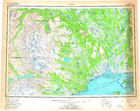
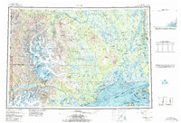
1958 Map of Tyonek
USGS Topo · Published 1967About this map
Tyonek and Old Tyonek stand along the western shore of Cook Inlet, anchoring a landscape where the river-fed Susitna Flats meet the high peaks of the Tordrillo Mountains. This survey reveals a mid-century Alaska transition, capturing the Tyonek Indian Reservation and small coastal outposts like Beluga and Ladd before modern infrastructure arrived. The network of the Susitna River and its tributaries, including the Yentna River and Skwentna River, provided the primary corridors for movement, evidenced by the Winter Trail stretching toward the interior.
Find a feature on this map
86 named features on this map. Tap any name to fly to it.
Don’t see what you’re looking for? This feature index may not catch every label — zoom into the map to look around manually.
Map Details
Editions of this 1958 Tyonek Map
6 editions found

Other maps of this area

1944 · Kenai
USGS Topo · 1:250,000

1946 · Lake Clark
USGS Topo · 1:250,000

1949 · Tyonek
USGS Topo · 1:250,000

1949 · McGrath
USGS Topo · 1:250,000

1949 · Anchorage D-8
USGS Topo · 1:63,360

1950 · Kenai
USGS Topo · 1:250,000

1950 · McGrath
USGS Topo · 1:250,000

1950 · Talkeetna Mountains
USGS Topo · 1:250,000

1950 · Talkeetna
USGS Topo · 1:250,000

1950 · Anchorage C-8
USGS Topo · 1:63,360