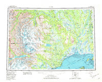
1958 Map of Tyonek
USGS Topo · Published 1982About this map
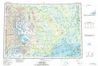
Tyonek and the surrounding wilderness of the Kenai Peninsula are captured here during a mid-century era of glacial study and infrastructure development. The landscape is defined by the massive peaks of the Tordrillo Mountains, including Mount Spurr and Mount Torbert, which feed an intricate network of waterways like the Chakachatna River and Skwentna River into the Cook Inlet. Evidence of early territorial transportation is visible through the historic Iditarod Trail, which winds through the interior toward Skwentna. On the eastern edge, the arrival of industrial modernization is marked by the Alaska Railroad corridor near Willow and Kashwitna, while a Pipeline and Transmission Line begin to trace the coastline from Beluga. The vast Susitna Flats and the protected lands of Lake Clark National Park and Preserve illustrate the delicate balance between the region's expanding settlements like Alexander and the massive glacial systems that dominate the northern topography.
Find a feature on this map
72 named features on this map. Tap any name to fly to it.
Don’t see what you’re looking for? This feature index may not catch every label — zoom into the map to look around manually.
Map Details
Editions of this 1958 Tyonek Map
6 editions found

Other maps of this area

1944 · Kenai
USGS Topo · 1:250,000

1946 · Lake Clark
USGS Topo · 1:250,000

1949 · Tyonek
USGS Topo · 1:250,000

1949 · McGrath
USGS Topo · 1:250,000

1949 · Anchorage D-8
USGS Topo · 1:63,360

1950 · Kenai
USGS Topo · 1:250,000

1950 · McGrath
USGS Topo · 1:250,000

1950 · Talkeetna Mountains
USGS Topo · 1:250,000

1950 · Talkeetna
USGS Topo · 1:250,000

1950 · Anchorage C-8
USGS Topo · 1:63,360