
1958 Map of Tyonek B-8
USGS Topo · Published 1963About this map
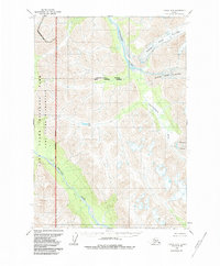
Glacial systems and braided waterways dominate this mid-century survey of the Tyonek B-8 quadrangle. The Skwentna River serves as a primary hydrological feature, receiving runoff from the extensive North Twin Glacier and South Twin Glacier which carve through the high elevations. The landscape is defined by the movement of ice and water, evidenced by the Harpoon Glacier and the Nagishlamina River further south.
Find a feature on this map
10 named features on this map. Tap any name to fly to it.
Don’t see what you’re looking for? This feature index may not catch every label — zoom into the map to look around manually.
Map Details
Editions of this 1958 Tyonek B-8 Map
2 editions found
Other maps of this area

1949 · Tyonek
USGS Topo · 1:250,000

1951 · Tyonek
USGS Topo · 1:250,000

1951 · Lime Hills
USGS Topo · 1:250,000

1958 · Tyonek C-8
USGS Topo · 1:63,360

1958 · Tyonek
USGS Topo · 1:250,000

1958 · Tyonek A-8
USGS Topo · 1:63,360

1958 · Lime Hills B-1
USGS Topo · 1:63,360
1958 · Lime Hills A-1
USGS Topo · 1:63,360
1958 · Tyonek B-7
USGS Topo · 1:63,360

1958 · Lime Hills C-1
USGS Topo · 1:63,360