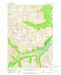
1958 Map of Lime Hills A-1
USGS Topo · Published 1965About this map
Merrill Pass serves as a critical geographic waypoint through this section of the Alaska Range, connecting the drainage basins that define the local topography. The area is dominated by high-altitude glacial features and prominent summits like Goldpan Peak and the distinctive landmark known as The Tusk. Drainage patterns are established by several significant watercourses, including the Igitna River, the Merrill River, and the curiously named Another River.
Find a feature on this map
7 named features on this map. Tap any name to fly to it.
Don’t see what you’re looking for? This feature index may not catch every label — zoom into the map to look around manually.
Map Details
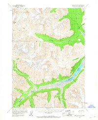
Editions of this 1958 Lime Hills A-1 Map
2 editions found
Other maps of this area

1944 · Kenai
USGS Topo · 1:250,000

1946 · Lake Clark
USGS Topo · 1:250,000

1949 · Tyonek
USGS Topo · 1:250,000

1950 · Kenai
USGS Topo · 1:250,000

1951 · Lake Clark
USGS Topo · 1:250,000

1951 · Tyonek
USGS Topo · 1:250,000

1951 · Lime Hills
USGS Topo · 1:250,000

1958 · Tyonek B-8
USGS Topo · 1:63,360

1958 · Kenai D-8
USGS Topo · 1:63,360

1958 · Tyonek
USGS Topo · 1:250,000