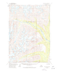
1958 Map of Lime Hills B-1
USGS Topo · Published 1978About this map
Glacial ice and high-altitude drainage systems dominate this remote Alaskan interior within the Kenai Peninsula Borough. The landscape is defined by the convergence of major glacial meltwater systems, including the Chilligan River, Styx River, and the Necons River. Steep-walled valleys and permanent ice fields are prominent, with several locations specifically noting the presence of hazardous crevasses among the high peaks. This 1958 survey, updated with limited revisions in the late 1970s, captures a transition zone where the Igitna River carves through the southern portion of the quadrangle. The lack of any marked roads or trails emphasizes the isolation of this terrain, where movement is dictated entirely by the river corridors and the shifting surface of the ice.
Find a feature on this map
6 named features on this map. Tap any name to fly to it.
Don’t see what you’re looking for? This feature index may not catch every label — zoom into the map to look around manually.
Map Details
Editions of this 1958 Lime Hills B-1 Map
2 editions found
Other maps of this area

1949 · Tyonek
USGS Topo · 1:250,000

1951 · Tyonek
USGS Topo · 1:250,000

1951 · Lime Hills
USGS Topo · 1:250,000

1958 · Tyonek B-8
USGS Topo · 1:63,360

1958 · Tyonek C-8
USGS Topo · 1:63,360

1958 · Tyonek
USGS Topo · 1:250,000

1958 · Lime Hills A-2
USGS Topo · 1:63,360

1958 · Tyonek A-8
USGS Topo · 1:63,360

1958 · Lime Hills B-1
USGS Topo · 1:63,360
1958 · Lime Hills A-1
USGS Topo · 1:63,360