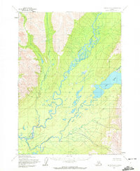
1954 Map of Lime Hills A-3
USGS Topo · Published 1972About this map
Stony River snakes through this wilderness landscape, forming a complex network of braids and oxbows across the valley floor. During the early 1950s, this region remained largely untouched by development, with the only evidence of human habitation being a lone Cabin situated near the shore of Two Lakes. The terrain is defined by the convergence of the Necons River and Kristin Creek with the larger Stony River system, creating an intricate watery corridor between rising elevations such as Patch. These unsurveyed land lines, predetermined by the Bureau of Land Management, highlight the isolation of the area at the time of the survey. The map serves as a primary record of the natural hydrology and early twentieth-century topography before significant modern changes.
Find a feature on this map
7 named features on this map. Tap any name to fly to it.
Don’t see what you’re looking for? This feature index may not catch every label — zoom into the map to look around manually.
Map Details
Editions of this 1954 Lime Hills A-3 Map
2 editions found
Other maps of this area

1946 · Lake Clark
USGS Topo · 1:250,000

1951 · Lake Clark
USGS Topo · 1:250,000

1951 · Lime Hills
USGS Topo · 1:250,000

1954 · Lime Hills A-3
USGS Topo · 1:63,360

1954 · Lime Hills B-4
USGS Topo · 1:63,360

1954 · Lake Clark D-3
USGS Topo · 1:63,360

1954 · Lime Hills A-4
USGS Topo · 1:63,360

1954 · Lime Hills B-3
USGS Topo · 1:63,360

1954 · Lake Clark D-4
USGS Topo · 1:63,360

1958 · Lime Hills A-2
USGS Topo · 1:63,360